
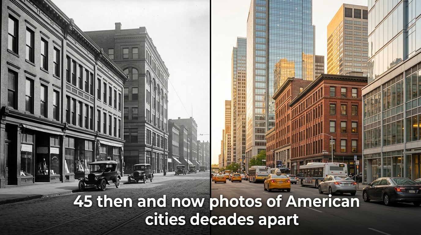
Time changes everything, especially cityscapes. In this collection of 45 then and now photos of American cities, you’ll see how urban landscapes have transformed over decades. Some changes reveal growth and renewal. Others show decline and reinvention. All of them tell stories about the forces shaping our nation.
I’ve always been fascinated by historical photographs. There’s something haunting about seeing a street corner frozen in time, knowing the people walking through it had no idea their moment would be preserved for future generations. These side-by-side comparisons do more than satisfy curiosity. They help us understand where we came from and where we’re going.
The following images span from the late 1800s through today. Each pair shows the same location photographed decades apart. You’ll notice patterns emerge. Some cities invested heavily in preservation. Others rebuilt completely after disasters. A few experienced dramatic decline. Together, they paint a picture of American urban transformation.
Table of Contents
Why American Cities Changed So Dramatically?
Before diving into the images, it helps to understand what drove these transformations. Then and now photos of American cities reveal several recurring themes that explain the differences you’ll see.
Highway Construction and Urban Renewal
The Interstate Highway System, begun in the 1950s, fundamentally reshaped American cities. Highways cut through established neighborhoods, displacing hundreds of thousands of residents. Boston’s Central Artery divided downtown from the waterfront for decades. Seattle’s Alaskan Way Viaduct blocked waterfront views. Both cities eventually removed these structures through massive engineering projects.
Urban renewal programs of the 1950s and 1960s demolished what officials called “blighted” areas. Often, these were thriving minority neighborhoods. The result was a loss of architectural character and community bonds that cities are still working to rebuild today.
Economic Booms and Busts
Detroit’s transformation tells a story of economic heartbreak. The Motor City reached its peak population of 1.85 million in 1950. Today, it has fewer than 650,000 residents. Its then and now photos show neighborhoods transformed from bustling streets to empty lots. The auto industry’s decline left an indelible mark on the city’s physical fabric.
Other cities boomed. Las Vegas grew from a desert outpost to a global entertainment destination. Phoenix expanded from a small regional city to America’s fifth-largest metropolis. These sunbelt cities show growth patterns that reflect migration from colder regions.
Population Shifts
The mid-20th century saw massive suburban expansion. People fled city centers for larger lots and newer homes in the suburbs. Downtown areas emptied out. Then, starting in the 1990s, the pattern reversed. Young professionals and empty nesters returned to urban cores, driving gentrification and new construction.
This back-and-forth movement created the visual contrasts you’ll see. A building photographed in 1965 might sit abandoned in a 1985 image. By 2015, that same structure could be renovated into luxury apartments. Cities don’t change in straight lines.
Architectural Preservation vs. Demolition
Some cities chose preservation. Charleston, Savannah, and parts of New York maintained their historic character through strong preservation laws. Other cities demolished freely. Houston has almost no historic downtown buildings left. Each approach created different visual legacies.
East Coast: Then and Now Photos of American Cities
The East Coast holds some of America’s oldest urban landscapes. European settlement patterns established streets that still exist today. These cities often grew around ports and railways, creating dense downtown cores.
New York City – Manhattan Bridge (1909 vs 2026)
The Manhattan Bridge opened in 1909, connecting Manhattan to Brooklyn across the East River. Early photographs show a city still developing around this new crossing. Streetcars and horse-drawn wagons shared the roads. Today, the bridge carries over 100,000 vehicles daily. The surrounding neighborhoods transformed from industrial warehouses to luxury apartments.
New York City – Grand Central Terminal (1913 vs 2026)
When Grand Central opened in 1913, it revolutionized train travel. The Beaux-Arts building featured the largest interior space in the country. Photographs from its early years show steam locomotives and crowds in formal attire. Today, the terminal serves over 750,000 visitors daily. Its celestial ceiling mural remains a highlight. The surrounding neighborhood shifted from rail yards to skyscrapers.
New York City – Empire State Building (1931 vs 2026)
The Empire State Building rose during the Great Depression. Opening in 1931, it stood as the world’s tallest building for 40 years. Historical images show its construction with workers balancing on steel beams without safety equipment. Today, the building competes with newer towers. Yet it remains an iconic symbol of American ambition.
New York City – Flatiron Building (1903 vs 2026)
Completed in 1902, the Flatiron Building quickly became one of New York’s most photographed structures. Its triangular shape resulted from the intersection of Broadway and Fifth Avenue. Early images show horse-drawn carriages surrounding the 22-story tower. The building still stands today, surrounded by tech startups and trendy restaurants.
New York City – Statue of Liberty (1886 vs 2026)
The Statue of Liberty arrived in New York Harbor in 1885. Assembly completed the following year. Early photographs show Bedloe’s Island as a military installation surrounding the statue. Today, Liberty Island is a national park. The statue’s copper skin has oxidized to its familiar green color. Over 4 million visitors tour it annually.
New York City – Times Square (1910 vs 2026)
Times Square wasn’t always the tourist destination we know today. In 1910, it was called Longacre Square. Theaters were just beginning to move to the area. Images show streets dominated by advertising billboards and horse-drawn carriages. The area declined in the 1960s and 1970s, becoming known for crime. Today’s bright lights and pedestrian plazas emerged from a 1990s revitalization effort.
New York City – The Bronx (1970s vs 2026)
The Bronx experienced dramatic decline. The 1970s saw arson and abandonment destroy entire blocks. Photographs from that era show burned-out buildings and vacant lots. Today, the borough has rebuilt. Grand Concourse, once lined with elegant apartment buildings, fell into disrepair but is recovering. The Bronx shows how cities can come back from disaster.
Boston – Central Artery (1995 vs 2026)
Boston’s “Big Dig” project transformed the city. The elevated Central Artery separated downtown from the waterfront for decades. I remember driving on that ugly green structure, seeing nothing but concrete walls. The project, completed in 2007, buried the highway underground. The resulting Rose Kennedy Greenway replaced asphalt with parks. Now residents and visitors can walk from downtown to the harbor unobstructed.
Boston – Scollay Square (1960 vs 2026)
Scollay Square was Boston’s entertainment district. Burlesque theaters and bars lined the streets. In the 1960s, urban renewal demolished the entire area. Today, Government Center sits where Scollay Square once stood. City Hall’s brutalist architecture replaced Victorian-era buildings. Some say Boston lost part of its soul in that transformation.
Philadelphia – City Hall (1910 vs 2026)
Philadelphia’s City Hall remains the largest municipal building in America. Completed in 1901, it features a 548-foot tower topped by a statue of William Penn. Early photographs show a city organized around this central landmark. For decades, a “gentleman’s agreement” prevented any building from exceeding City Hall’s height. That changed in the 1980s. Today, skyscrapers tower over Penn’s statue.
Baltimore – Inner Harbor (1955 vs 2026)
Baltimore’s Inner Harbor transformed from industrial waterfront to tourist destination. In the 1950s, photographs show warehouses, shipping piers, and railroad tracks. The area declined as shipping moved elsewhere. In the 1970s, redevelopment began. Today, the National Aquarium, Maryland Science Center, and shops draw millions of visitors. It’s become a model for waterfront revitalization.
Washington D.C. – National Mall (1910 vs 2026)
The National Mall wasn’t always the grand lawn we see today. Early 1900s photographs show the Washington Monument standing in an open field. Railroad tracks cut across what is now green space. The McMillan Plan of 1901 envisioned the Mall as a symbolic center. Over decades, that vision became reality. Museums, memorials, and reflecting pools created the iconic landscape.
Pittsburgh – Steel Mills (1940 vs 2026)
Pittsburgh was once America’s steel capital. Photographs from the 1940s show mills lining the rivers, smoke filling the sky. The city was known for its pollution. Business leaders even kept streetlights on during the day to cut through the haze. When the steel industry collapsed in the 1980s, Pittsburgh reinvented itself. Today, healthcare, education, and technology drive its economy. The mills are gone, replaced by parks and office buildings.
Midwest: Then and Now Photos of American Cities
Midwestern cities grew around industry, railroads, and agriculture. Many reached their peak populations mid-century before experiencing decline. Their then and now photos often show the dramatic effects of economic transition.
Chicago – Michigan Avenue (1920 vs 2026)
Chicago’s Michigan Avenue showcases architectural evolution. The 1920s saw the construction of landmark buildings like the Wrigley Building and Tribune Tower. Photographs from that era show a city establishing its vertical identity. Today, street-level changes include wider sidewalks and landscaping. The buildings remain, but the context has shifted toward pedestrian comfort.
Chicago – Skyline from Lake Michigan (1940 vs 2026)
Chicago’s skyline transformation is remarkable. In 1940, the skyline featured the Tribune Tower, Willis Tower (then Sears Tower), and other early skyscrapers. Today, the view includes dramatically more towers. New construction continues. The city’s architectural heritage makes it one of America’s most photographed skylines.
Detroit – Downtown (1950 vs 2026)
Detroit’s downtown tells a story of decline and partial recovery. In 1950, the city was America’s fourth largest. Photographs show bustling streets, packed streetcars, and thriving department stores. By the 1980s and 1990s, many buildings stood empty. Renaissance Center, built in the 1970s, was meant to revive downtown. It became an isolated fortress. Recent years brought new investment. Buildings have been renovated. But the city has not returned to its peak population.
Detroit – Neighborhoods (1960 vs 2026)
Detroit’s residential neighborhoods show even starker changes. The 1960s photographs capture dense blocks of single-family homes. Today, many of those neighborhoods have significant vacant land. Houses were abandoned and demolished. Some areas now have more empty lots than buildings. Urban farming has replaced housing in some places. It’s a visual record of economic devastation.
St. Louis – Gateway Arch Area (1935 vs 2026)
The Gateway Arch didn’t exist before 1965. Photographs from 1935 show a riverfront industrial area with warehouses and rail yards. The Jefferson National Expansion Memorial project cleared 40 blocks. The arch, designed by Eero Saarinen, became America’s tallest monument at 630 feet. Today, it’s surrounded by a park. The city sacrificed a historic district for an iconic landmark.
Cleveland – Flats District (1955 vs 2026)
Cleveland’s Flats district sat where the Cuyahoga River meets Lake Erie. Photographs from the 1950s show a working industrial area. Factories lined the riverbanks. The area declined as industry left. In the 1980s and 1990s, it became a nightlife district. Bars and clubs filled old industrial buildings. Then that declined too. Today, redevelopment continues. The Flats show how industrial areas can find new purposes.
Minneapolis – Downtown (1955 vs 2026)
Minneapolis has grown steadily. Photographs from the 1950s show a modest skyline. Today, the city features a much larger core of office towers. The IDS Center, built in 1973, sparked a building boom. Skyways connect buildings above street level, creating a second pedestrian network. This system defines Minneapolis winters.
Cincinnati – Riverfront (1945 vs 2026)
Cincinnati’s riverfront transformed dramatically. Photographs from the 1940s show a working port with steamboats and barges. Rail lines lined the river. In the 1970s, Riverfront Stadium was built for baseball and football. That was demolished in 2001. Today, Great American Ball Park and Paul Brown Stadium occupy the riverfront. The Banks development added restaurants and apartments.
Indianapolis – Monument Circle (1910 vs 2026)
Indianapolis was planned around Monument Circle. The Soldiers and Sailors Monument, completed in 1901, anchors the city’s layout. Photographs from the 1910s show a bustling public space. Streetcars circled the monument. Today, the space serves similar purposes. Events, protests, and celebrations happen here. The surrounding buildings evolved but the circle remained.
Milwaukee – Downtown (1960 vs 2026)
Milwaukee’s downtown has revitalized. Photographs from the 1960s show a declining urban core. Department stores were closing. People shopped in suburbs. Recent decades brought investment. The Riverwalk system connected downtown to neighborhoods. New apartment buildings replaced vacant lots. The city’s brewery heritage now drives tourism.
Kansas City – Downtown (1950 vs 2026)
Kansas City experienced similar patterns. Photographs from the 1950s show a vibrant downtown with streetcars and busy sidewalks. Suburban flight hollowed out the core. Recent years brought renewal. The Power and Light District added entertainment venues. A new streetcar line reconnected downtown. Kansas City shows how transit can drive urban recovery.
South: Then and Now Photos of American Cities
Southern cities experienced different growth patterns. Many boomed after World War II as air conditioning made hot climates comfortable. Their then and now photos often show dramatic expansion.
Atlanta – Downtown (1965 vs 2026)
Atlanta’s growth symbolizes the New South. Photographs from the 1960s show a modest skyline. The city was smaller than Birmingham or New Orleans. Today, Atlanta is the South’s largest city. Hartsfield-Jackson Airport became the world’s busiest. Downtown fills with corporate headquarters. The 1996 Olympics accelerated development. Atlanta transformed from regional city to global player.
Houston – Skyline (1965 vs 2026)
Houston’s skyline transformation is among the most dramatic. In 1965, the city had a modest collection of towers. The oil boom of the 1970s and 1980s transformed it. Today, Houston has one of America’s largest skylines. The lack of zoning allowed development anywhere. The result is a city that feels like multiple downtowns connected by highways.
Dallas – Downtown (1955 vs 2026)
Dallas grew alongside the oil industry and banking. Photographs from the 1950s show a compact downtown. The assassination of President Kennedy in 1963 changed the city’s image. In recent decades, Dallas invested heavily in arts and culture. The Arts District became the largest in America. Downtown added housing, reversing decades of decline.
Miami – South Beach (1985 vs 2026)
Miami’s South Beach transformation is remarkable. In the 1980s, the area was known for crime and elderly residents. Photographs show faded Art Deco hotels and empty beaches. Then came a renaissance. Preservationists protected the historic architecture. Television shows like Miami Vice boosted the city’s image. Today, South Beach is a global destination. The Art Deco buildings shine in bright colors.
Charlotte – Uptown (1985 vs 2026)
Charlotte is a banking powerhouse. Photographs from the 1980s show a small city skyline. Bank of America and Wachovia drove explosive growth. Today, Charlotte is America’s second-largest banking center after New York. The population more than tripled since 1980. Uptown’s towers reflect that growth. The city went from regional center to national player.
New Orleans – French Quarter (1945 vs 2026)
New Orleans preserved more of its historic character than most cities. Photographs from the 1940s show a French Quarter remarkably similar to today. Cast-iron balconies and narrow streets remain. Preservation laws protected the area from demolition. The changes are subtle. Tourism replaced residents as the primary activity. But the physical character remains.
Nashville – Broadway (1965 vs 2026)
Nashville’s Broadway transformed from local honky-tonks to tourist destination. Photographs from the 1960s show modest storefronts. Country music was establishing itself. Today, Broadway is “Honky Tonk Highway.” Neon signs fill every building. Tour buses line the street. The Ryman Auditorium and Country Music Hall of Fame anchor a massive tourism industry.
San Antonio – River Walk (1945 vs 2026)
San Antonio’s River Walk is an urban success story. In the 1920s, the river flooded repeatedly. The city considered paving it over. Instead, architect Robert Hugman designed a curved walkway along the banks. Photographs from the 1940s show the early River Walk. Today, it’s a 15-mile linear park. Restaurants and hotels line the water. It’s one of Texas’s most visited attractions.
Memphis – Beale Street (1955 vs 2026)
Beale Street is the home of the blues. Photographs from the 1950s show the street at its peak. Music clubs lined the blocks. B.B. King, Louis Armstrong, and others performed here. The area declined in the 1960s and 1970s. By 1970, Beale Street was nearly empty. Revitalization in the 1980s brought back music clubs. Today, it’s a tourist destination celebrating its musical heritage.
Fort Worth – Stockyards (1945 vs 2026)
Fort Worth’s Stockyards preserve cowboy culture. Photographs from the 1940s show a working cattle operation. Thousands of animals moved through the pens. The meatpacking industry drove the local economy. Today, the Stockyards is a historic district. Tourists watch cattle drives. Western shops and saloons fill the buildings. It’s a theme park version of history, but authentic in its bones.
West Coast: Then and Now Photos of American Cities
West Coast cities are younger but grew explosively. Their then and now photos often show the most dramatic changes, as small settlements became major metropolises.
Los Angeles – Hollywood Sign (1923 vs 2026)
The Hollywood Sign originally read “Hollywoodland.” It was a real estate advertisement. Photographs from 1923 show the original installation on Mount Lee. The sign deteriorated over decades. In the 1970s, it was rebuilt without the “land.” Today, it’s one of the world’s most recognizable landmarks. The sign went from advertising to icon.
Los Angeles – Downtown (1910 vs 2026)
Los Angeles downtown transformation is striking. Photographs from 1910 show a small city center. The city had just 300,000 residents. Streetcars dominated transportation. Today, Los Angeles has nearly 4 million people. Downtown grew and then declined. It’s now experiencing a renaissance. New residents fill converted office buildings. The Angels Flight funicular reopened after decades.
San Francisco – Vallejo Street (1915 vs 2026)
San Francisco rebuilt after the 1906 earthquake. Photographs from 1915 show a city under construction. Vallejo Street in North Beach retained its steep character. The cable cars that once dominated the city’s hills were reduced to tourism operations. Today, the street remains much the same. Preservation protected San Francisco’s character more than most cities.
San Francisco – Golden Gate Bridge Construction (1933 vs 2026)
The Golden Gate Bridge changed San Francisco. Photographs from 1933 show construction in progress. Workers balanced on cables without safety equipment. The bridge opened in 1937, connecting San Francisco to Marin County. Today, it carries over 40 million vehicles annually. It’s one of the most photographed bridges in the world.
Seattle – Alaskan Way Viaduct (1953 vs 2026)
Seattle’s Alaskan Way Viaduct opened in 1953. Photographs from that era show an elevated highway along the waterfront. It blocked views and cut off downtown from the water. The 2001 Nisqually earthquake damaged the structure. After years of debate, Seattle replaced it with a tunnel. In 2019, the viaduct was demolished. Today, the waterfront is being redeveloped as parks and public space.
Portland – Downtown (1965 vs 2026)
Portland’s downtown transformed from auto-oriented to pedestrian-focused. Photographs from the 1960s show a declining retail core. Department stores closed as people shopped in suburbs. In the 1970s, the city built a bus mall and limited downtown parking. Later, light rail replaced cars. Today, Portland’s downtown is walkable and vibrant. Food carts fill parking lots. The Pearl District converted warehouses to apartments.
San Diego – Balboa Park (1915 vs 2026)
Balboa Park hosted the 1915 Panama-California Exposition. Photographs from that era show Spanish Colonial Revival buildings constructed for the fair. The buildings were meant to be temporary. Instead, they became permanent museums and theaters. Today, Balboa Park is the largest urban cultural park in America. The architecture remains, now housing museums, theaters, and the San Diego Zoo.
Sacramento – Downtown (1955 vs 2026)
Sacramento’s downtown has seen both decline and renewal. Photographs from the 1950s show a busy main street with department stores and theaters. The Westfield shopping mall drew customers away in later decades. Recent years brought new investment. The arena district added housing and entertainment. Old Sacramento preserved the historic riverfront area.
Las Vegas – Strip (1955 vs 2026)
Las Vegas Strip transformation is dramatic. Photographs from 1955 show modest casinos along a two-lane road. The Sands, the Dunes, and the Flamingo were among the first major resorts. In the 1990s, the megaresort era began. Today, massive complexes like the Bellagio, MGM Grand, and Resorts World dominate. The Strip generates billions in revenue. It went from desert outpost to global destination.
Denver – Skyline (1975 vs 2026)
Denver’s skyline grew with the energy industry. Photographs from the 1970s show a modest collection of towers. The oil boom brought new construction. Then came the bust in the 1980s. Denver diversified into technology and telecommunications. Today, the city is thriving again. Population grew by over 200,000 since 2010. The skyline reflects that growth.
Phoenix – Downtown (1955 vs 2026)
Phoenix is America’s fastest-growing major city. Photographs from the 1950s show a small downtown in a vast valley. Air conditioning and interstate highways drove growth. Today, Phoenix has over 1.6 million residents. The metro area exceeds 4.5 million. The downtown struggled as growth sprawled outward. Recent investments aim to create an urban core in a suburban region.
What We Learn From Then and Now Photos of American Cities
Looking at these 45 comparisons, patterns emerge. Cities don’t grow in straight lines. They surge, decline, and sometimes recover. Some decisions shaped cities for generations. Highway placement, urban renewal, and preservation choices created the landscapes we see today.
The then and now photos of American cities also reveal what was lost. Beautiful buildings demolished for parking lots. Vibrant neighborhoods destroyed by highway construction. Walkable streets replaced by auto-oriented sprawl. These losses fuel today’s preservation movements.
They also show what’s possible. Boston buried its highway and created a park. San Antonio turned a flood-prone river into a destination. New York transformed Times Square from seedy to spectacular. Cities can change course. Better urban design is always possible.
Frequently Asked Questions
Which US city is shrinking the fastest?
Detroit has been the fastest-shrinking major American city, losing over 60% of its population since its 1950 peak. However, in recent years, cities like St. Louis and Cleveland have also experienced significant population decline as a percentage of their peak.
How has America changed in the last 50 years?
America has transformed dramatically since the 1970s. Suburban sprawl expanded while many city centers declined. Then, starting in the 1990s, urban cores saw renewed investment. The population shifted from the Midwest and Northeast toward the South and West. Manufacturing jobs decreased while technology and service industries grew. Highways that once divided cities are being removed in many places.
What did American cities look like in the 1900s?
In the early 1900s, American cities were dominated by streetcars, horses, and pedestrians. Buildings were typically 5-10 stories tall. Manufacturing and warehouses lined waterfronts. Air pollution was severe in industrial cities. Downtowns were dense and walkable. There were no parking lots or highways. Most residents lived in walk-up apartments or row houses near their workplaces.
Has photography changed over the years?
Photography has changed enormously since the 1800s. Early photographs required long exposures and large equipment. By the 1930s, handheld cameras made candid shots possible. Color photography became common in the 1950s and 1960s. Digital photography, beginning in the 1990s, democratized image-making. Today, billions of photographs are taken daily on smartphones.
Where can I find old photos of my city?
Historical photos can be found at local historical societies, public libraries, and university archives. The Library of Congress and National Archives have massive digitized collections. Websites like Shorpy, Archive.org, and state-specific digital archives offer free access. Local Facebook groups and Reddit communities often share neighborhood-specific historical images. City planning departments may also maintain photographic records.
Conclusion
These 45 then and now photos of American cities decades apart reveal a nation in constant transformation. Some cities preserved their heritage. Others chose to rebuild. A few experienced dramatic decline. Each image tells a story about decisions made, opportunities seized or missed, and the passage of time itself.
I find hope in these comparisons. Cities that declined can recover. Neighborhoods that were destroyed can be rebuilt, differently but vibrantly. The choices we make today will appear in future then-and-now comparisons. We have the power to shape what those images show.
The story of American cities continues. As you look at these transformations, consider what your own city might look like in another 50 years. What should be preserved? What should change? These photographs give us perspective. They help us see our own moment in the long arc of urban history.